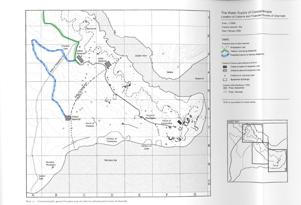
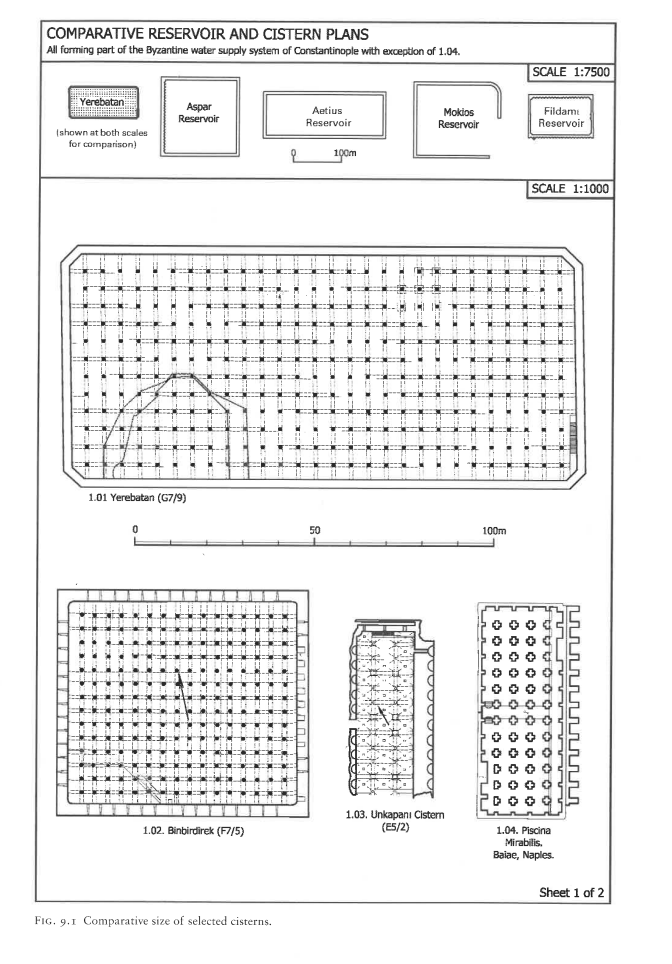
The largest open reservoir, 170 × 147 × 12 m located in region XII with a potential storage of c. 299,880 m3. Due to the immense water pressure, the reservoir probably could have withstood being filled at most to 9.5 m (out of 12 m). The Mocius cistern is located on an altitude of 55 m on the VIIth hill, also known as 'Xerolophos' ('Dry Hill') since no main lines of the Hadrian and Valens waterway ran close to it. However, the supply of the Mocius reservoir could be explained if it were supplied by a branch of the Thracian supply line (see map in images). Such a water channel in the region is mentioned in the 10th century Book of Ceremonies. The water demand in this area may have been limited, and only three other cisterns are located in this area (B7/1, B9/1, C7/1). The Mocius reservoir was likely named after St Mokios, of whom a church was nearby. Its location - alongside that of the other great open reservoirs of Aetius and Aspar - between the Constantinian and Theodosian walls hint that the water was used for agricultural purposes. Nonetheless, the Mocius reservoir is somewhat different from the other two reservoirs, since the brick bonding courses are slightly different. The technique is not typically from the 5th century, and can be paralleled with brickwork from the Anastasian wall in the northern sector of the wall (Crow et al., 2008, p. 15, 122-3, 128-132).
Built alongside the Reservoirs of Aetius and Aspar after the addition of the second line from Vize to the Valens Waterway. It probably needed an additional channel to be supplied from the Valens Waterway, see 'Book of Ceremonies' (Crow et al., 2008, p. 122). An Arab account of Constantinople (c. 910) describes the different branches of the Hadrian and Valens Waterways, and seems to imply that the upper line was connected to the Mocius reservoir (Crow et al., 2008, p. 20).
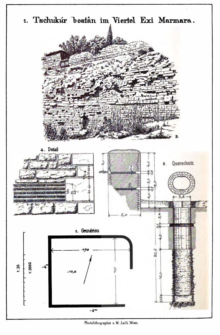
Today, it is a multipurpose recreation park called Findikzade Çukurbostan Park.
Literary evidence
The construction of the cistern was first attributed to Anastasius by the Patria (10th century). The channel that supplied it was mentioned in the Book of Ceremonies (1.8).
In the 13th century, Nikolaos Mesarites still lists the reservoirs as "sweet water made qual to seas" (Church of the Holy Apostles in Constantinople 4.1-3). This could hint that the cistern was still in use after the restoration of Constantine V in 766.
In the late 15th century, Codex Matritensis Graecus lists the "Of Mukusia" as a highlight of the city.
Gilles (mid-16th century) saw the cistern next to the remains of the Church of Mocius; he reports the cistern was being used as a garden. Gilles attributes its construction to Justinian, but acknowledges that other sources have listed Anastasius (De Topographia Constantinopoleos 1.18, 4.8).