Installation details

english name
Valens aqueduct bridge
turkish name
Bozdoğan Kemeri, Valens Su Kemeri
original name
Άγωγὸς τοῦ ὔδατος (Agōgòs toū húdatos); Μέγας ἀγωγὸς τοῦ Οὐάλεντος (Mégas agogòs toū Ouálentos)
ottoman name
Kemer-i âb-ı revan, Eski Kemerler
events
event persons
-
purposes
still exists
Yes
type
Aqueduct bridge
location
-
description

The Valens Aqueduct Bridge is a 971-meter-long structure with 86 arches, built as part of the Valens Waterway to supplement the earlier Hadrian Waterway and meet the growing water demands of Constantinople. Unlike its predecessor, the Valens system supplied water to the city’s higher elevations, crossing the valley between the Fourth and Third Hills at an altitude of 56–57 meters above sea level. As a gravity-fed system, the aqueduct bridge was essential for maintaining water flow across lower valleys. Within the city walls, the Valens Waterway likely served installations up to 59.5 meters in elevation. Today, the bridge is known as Bozdoğan Kemeri ("Aqueduct of the Grey Falcon"). Its upper section has been capped with modern cement, as the aqueduct ceased its original function in the 20th century. A fragmentary chrismon on the keystone of Arch 30 suggests that the bridge was either constructed or underwent significant repairs in the late 4th or 5th century (Crow et al., 2008, p. 118).

comments

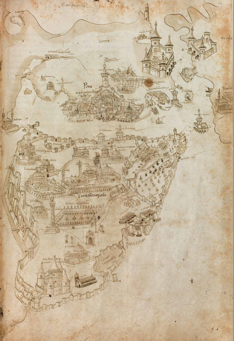
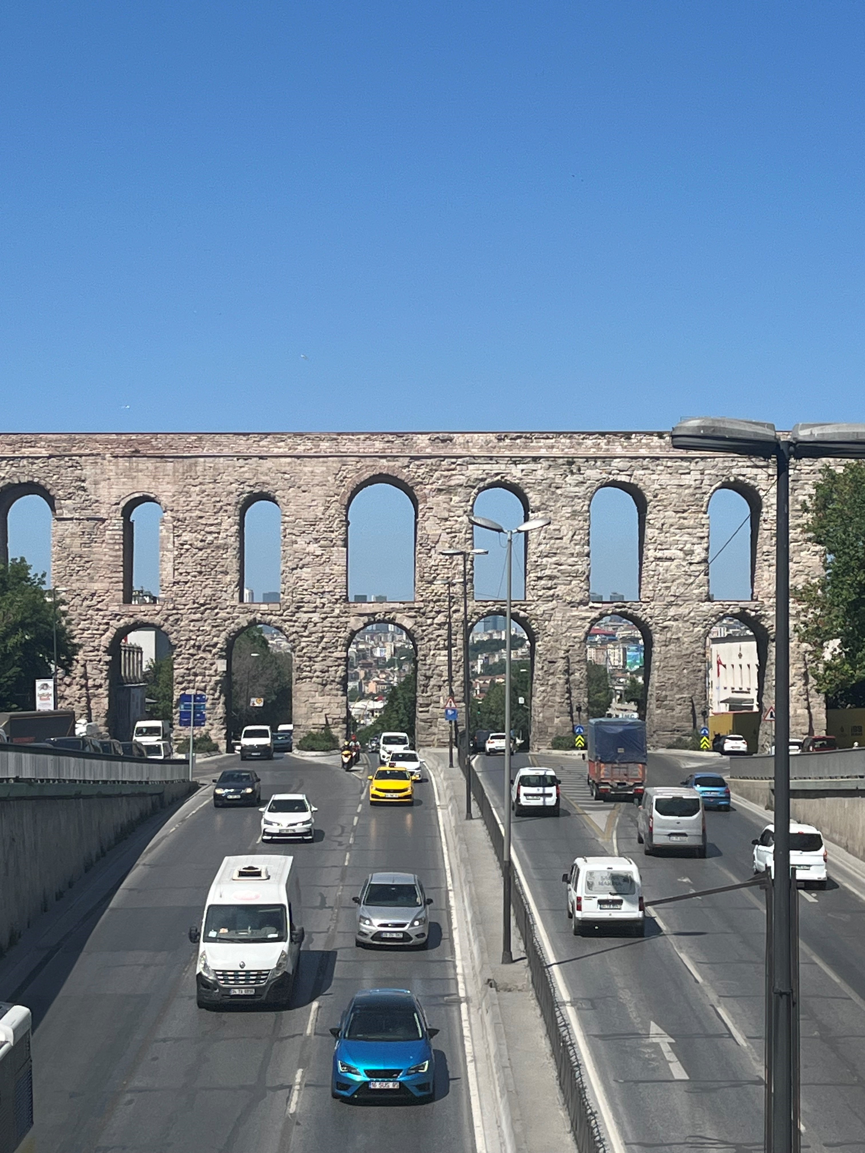
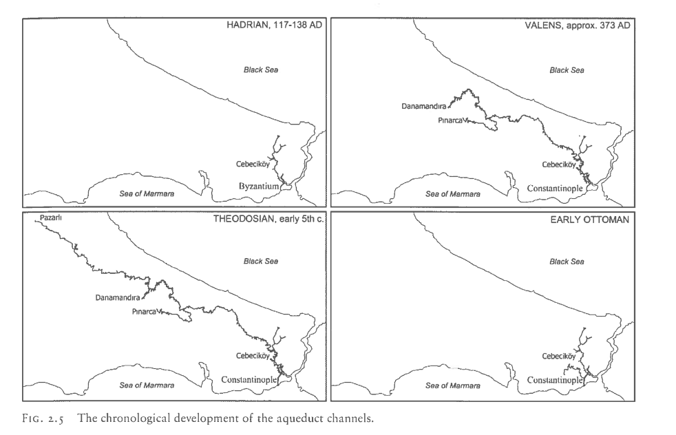
The name 'Valens aqueduct' is confusing because it is used both for the whole waterway and for the aqueduct bridge that still exists. We use the name 'Valens aqueduct bridge' for the latter.

The attribution of this aqueduct bridge to Valens relies on the unreliable Patria and Parastaseis (the bridge is mistakingly sometimes attributed to Valentinian too), but its elevation indicates that this bridge could only have been part of the high level water supply.

See further Crow et al., 2008, p. 118-121.

systems
external
-
 
The map is found in Cristofor Buondelmonti